
What is the Costa Verde and why is it one of Brazil's most beautiful places?
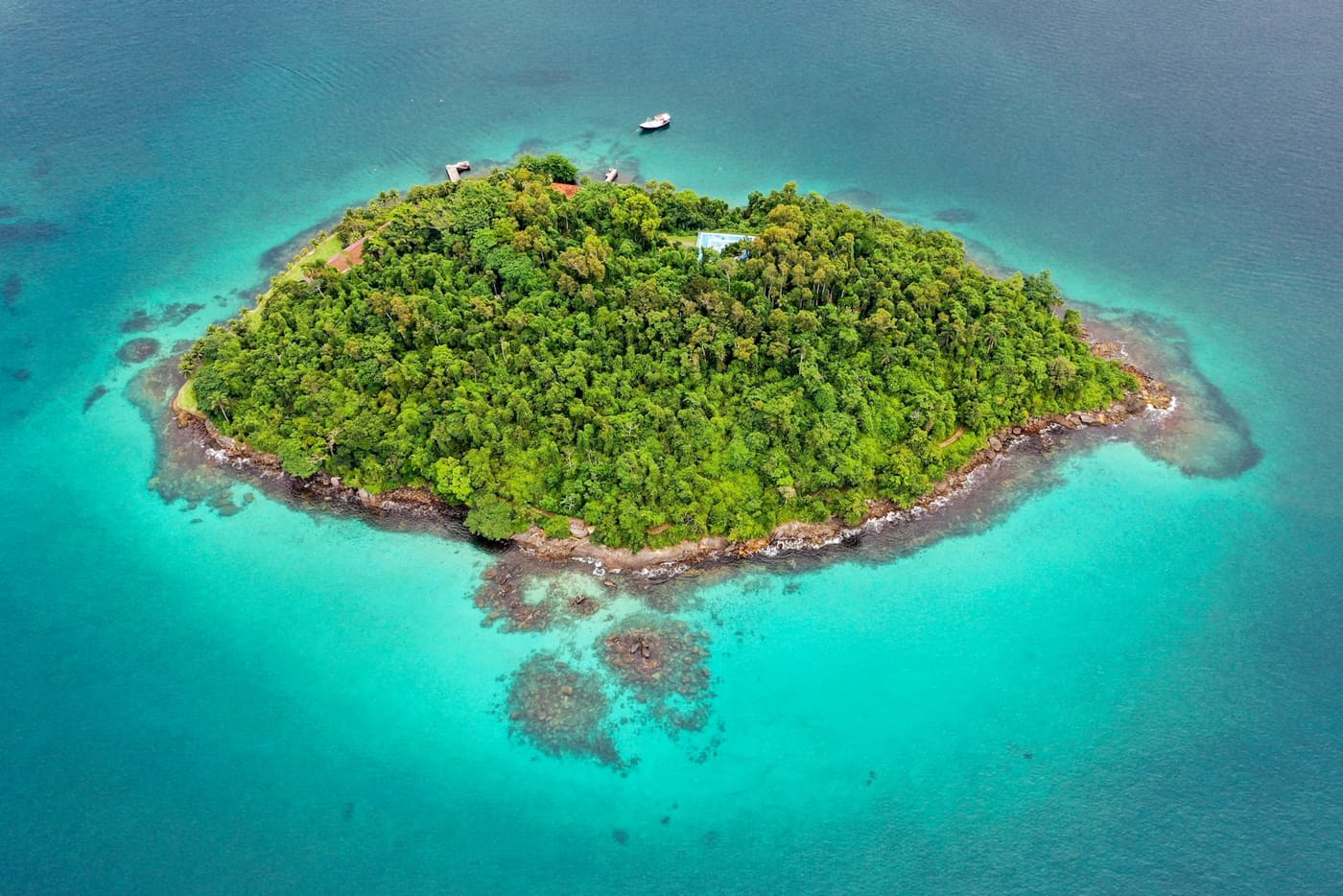
“Costa Verde” shows up in state law, in agency packages, in backpacker conversations and in posts by foreigners who just discovered Paraty. Each of those uses means something slightly different, and we live inside other people’s confusion: our home is the historic center of Ilhabela, at the São Paulo end of the region, and we spend the year answering this question for travelers who have just stepped off the ferry and are still staring at the forest-covered slopes, looking like they did not expect quite this much green.
This article exists to settle the confusion once and for all: what the Costa Verde is, where the name came from, what history and geography have to do with it, and why so many people consider this the most beautiful coastline in Brazil. If you already know the concept and want to get practical, our definitive guide to the Costa Verde gathers destinations, transport, seasons and itineraries in a single article. Here the subject is understanding the place.
The short answer
The Costa Verde is the stretch of Brazilian coast between Rio de Janeiro and São Paulo where the Serra do Mar mountain range meets the ocean. There is no plain between the mountains and the beach: the Atlantic Forest runs down the slope and ends at the sand, and it is that continuous green wall, reflected in coves of calm water, that gave the region its name. Within that stretch sit Paraty, Angra dos Reis, Ilha Grande, Trindade, Ubatuba, Maresias and Ilhabela, each with its own personality, all stitched together by the same road.
Now the long answer, because it is worth your time.
What the law says (and what it leaves out)
Officially, the Costa Verde is a tourism region of Rio de Janeiro state, and of Rio only. The boundary drawn by state law in 2002 covers four municipalities: Itaguaí, Mangaratiba, Angra dos Reis and Paraty. That is the version on the maps of the Rio state tourism office and in the Ministry of Tourism’s documents.
It helps to understand what that list means in practice. Itaguaí, first in line, is essentially a port and industrial city: almost no traveler stops there, and it works as a gateway for anyone coming from Rio. Mangaratiba enters the radar for one specific reason, the ferry to Ilha Grande. The actual tourism concentrates in Angra and Paraty, which is why the legal definition, correct on paper, is a poor description of the trip people really take.
And it leaves out half the story, because the landscape does not ask for a passport at the São Paulo state line.
The map travelers use
Anyone driving the Rio-Santos notices something the law does not capture: nothing changes when the state changes. The mountains keep falling into the sea past Paraty, the caiçara fishing villages keep appearing in Ubatuba, the islands keep dotting the horizon all the way to Ilhabela. That is why itineraries, foreign guidebooks and this blog treat the whole corridor between Mangaratiba (RJ) and São Sebastião (SP) as the Costa Verde: about 294 km of road that also takes in Ubatuba, Maresias and Ilhabela.
That reading earned an institutional stamp in 2025, when Angra dos Reis, Paraty, Ubatuba and Ilhabela joined forces in the Rota Verde Azul, an integrated destination across the two states that adds up to around 2,200 beaches on the official count, along with the state parks, the waterfalls and the historic heritage of the same corridor. In other words: even the city governments have admitted the state line is a bureaucratic detail in the middle of a single region.
For anyone planning a trip, the consequence is simple: think of the Costa Verde as a line, not a point. You can enter on one side and leave on the other, and that shape pays off far more than driving in and doubling back. We explore that logic in the article on what exists between São Paulo and Rio beyond the two capitals and in the full route from Rio to São Paulo along the coast.
The geography that manufactures the scenery
Everything impressive about the Costa Verde comes from a single geological fact: on this stretch, the Serra do Mar abandons the interior and runs right against the coast. The granite escarpments drop straight into the water, and the result is a shoreline without a coastal plain, deeply indented, with sheltered coves, rocky headlands and short beaches squeezed between hills.
The islands are part of the same phenomenon. Ilha Grande and Ilhabela are, in practice, pieces of the mountain range surrounded by sea: the first climbs to the 982 meters of Pico do Papagaio, the second is the country’s largest sea island. The bay of Angra gathers 365 islands and Paraty has another 65 in its inner sea. Add Ubatuba, with more than 100 beaches along 106 km of coast, and the Rota Verde Azul’s count of 2,200 beaches starts to make sense.
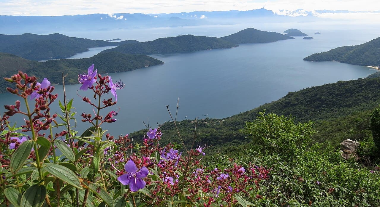 Saco do Mamanguá, in Paraty: the mountains walking into the sea. Photo: Pedro Gabriel Maciel, CC BY-SA 3.0, Wikimedia Commons
The mountains also explain the climate. The moisture the ocean sends inland hits the wall of peaks and turns into rain right there, which keeps the forest dense all year and feeds the short rivers that tumble down the slopes. That is why the region concentrates so many waterfalls (we list the best in our guide to the best waterfalls of the Costa Verde) and why summer is generous with late afternoon downpours. Rain, here, is not a defect: it is the mechanism that manufactures the green.
A history in three acts
The first act is gold. In the 18th century, the metal mined in Minas Gerais came down the mountains on a stone-paved trail, the Caminho do Ouro (the Gold Trail), and shipped out of the port of Paraty bound for Portugal. That flow paid for the townhouses, the churches and the paving that make Paraty’s historic center the best preserved colonial ensemble on the Brazilian coast.
The second act is oblivion, and it turned out to be luck in disguise. When the Portuguese crown opened a more direct route between the mines and Rio de Janeiro, Paraty lost its role as a port and slid into decline. The whole region stayed isolated for generations, reachable almost only by sea. With no new money coming in, nobody demolished anything to build on top of it: isolation froze the town from the 18th century until the 20th, when Brazil rediscovered what it had there and placed the whole ensemble under heritage protection.
The third act has asphalt. In the 1970s, the construction of the Rio-Santos highway (the BR-101) stitched the fishing villages together for the first time between the country’s two largest urban centers. Tourism came along for the ride, for better and for worse. The road remains single lane for most of its length, winding and slow, and maybe that is why the region never became a coastline of high-rises: anyone who wants a tower on the beach has easier places to reach. Whoever takes on the curves is after something else.
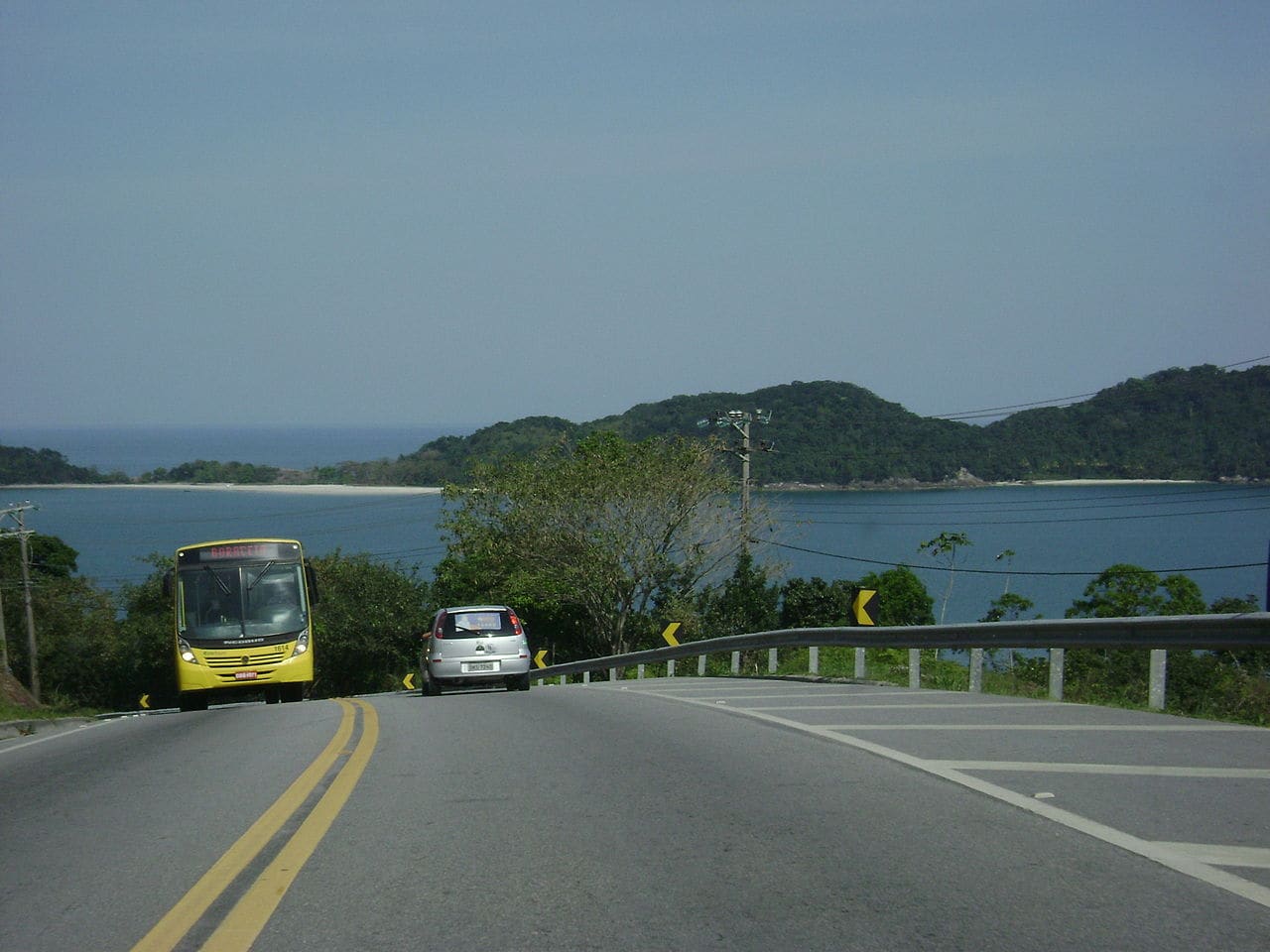 The Rio-Santos, opened in the 1970s: a single lane between the mountains and the sea. Photo: Cacobianchi, public domain, Wikimedia Commons
The UNESCO recognition
In 2019, UNESCO inscribed “Paraty and Ilha Grande - Culture and Biodiversity” on the World Heritage list. The technical detail matters: it was Brazil’s first mixed site, a rare category that recognizes a place for its cultural and its natural value at the same time. The colonial townhouses and the Gold Trail entered for culture; the preserved Atlantic Forest, with threatened species like jaguars and muriqui monkeys living a few kilometers from the beach, entered for nature.
For you, the traveler, the title works as a seal of authenticity with practical consequences: the preservation rules are taken seriously, which is why Ilha Grande still has no cars and no roads, and Paraty’s center still has no concrete utility poles in the middle of the townhouses.
Why “green”, after all
The name did not come from an advertising campaign. It came from the obvious observation of anyone who drives the road: this is the most visible stretch of continuous Atlantic Forest in the country, a corridor where the forest occupies the entire landscape, from the mountain crest to the waterline. And the green does not stop at the sand. In the sheltered coves, the shallow sea over a pale bottom takes on greenish tones that supplied the “blue” half of the newer nickname; anyone who has seen the bay of Angra from above understands why the Rota Verde Azul is called what it is.
Why it ranks among Brazil’s most beautiful places
We avoid empty superlatives, so here is the argument in facts. In about 300 km of road, the Costa Verde gathers: a protected historic center where the high tide comes in through the stone streets; an island 982 meters tall where there is not a single car; the country’s largest sea island; a bay with 365 islands; and beaches like Lopes Mendes, which shows up regularly on international lists of the world’s most beautiful. We do not know another stretch of the Brazilian coast with this density of different things so close together. That is what makes it special: not one isolated postcard, but the sequence of them.
A note of transparency before we close: this blog is written by the team of Hostel da Vila, an eco lodge open since 2016 in Ilhabela’s historic center. The Atlantic Forest this article keeps mentioning is not window scenery for us: there are 8,000 m² of it around the accommodations, and it is under that forest that our day ends, in the 32°C water of the heated pool, listening to the forest stay awake.
If the explanation won you over, the next step is practical: see how to plan your first Costa Verde trip, check the best time to visit and build your days with the 7 day itinerary. The region explains the rest in person.