
What to do between São Paulo and Rio beyond the two cities
The route between São Paulo and Rio de Janeiro is one of the most flown in the world, and almost everyone who covers it does so looking at a phone screen. Down below, meanwhile, runs one of the most beautiful coastlines on the planet: bays with hundreds of islands, an 18th century colonial center, beaches you can only reach on foot and the country’s largest sea island. Drivers on the Dutra highway see none of it either. The mountains hide everything. We know because we write from inside that hidden stretch: the people behind this guide live on the Costa Verde and have been hosting travelers here since 2016, so consider the enthusiasm an informed bias.
The stretch has a name and it is not a half-hour detour: it is a 294 km corridor along the Rio-Santos highway, between Mangaratiba (RJ) and São Sebastião (SP), passing through Angra dos Reis, Paraty, Ubatuba, Maresias and Ilhabela. Since 2019, Paraty and Ilha Grande have been a UNESCO World Heritage site, the first in Brazil recognized for culture and nature at the same time. If you have never heard of the region as a single destination, start making sense of the concept in the article what is the Costa Verde.
The idea of this guide is simple: you are going to travel between the two cities anyway. Instead of 6 hours on the Dutra or 1 hour on a plane, what if the route became the trip itself?
The math nobody does
By car, trading the Dutra for the Rio-Santos costs time: the coastal road is single lane, full of curves, and the full run takes two unhurried days (or one long, rushed day, which we do not recommend). But that cost buys a different trip. Every extra hour on the road is a beach, a village, a lookout.
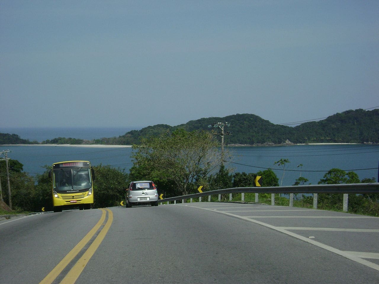 The Rio-Santos stitches mountains and sea together for 294 km. Photo: Cacobianchi, public domain, Wikimedia Commons
Without a car it also works: Costa Verde company buses run down from Rio to Angra and Paraty, Pássaro Marron connects São Paulo to Ubatuba and São Sebastião, and Colitur covers the middle section of Angra, Paraty and Trindade. The weak link is the Paraty to Ubatuba hop, which has few departures and calls for planning. We mapped it all in the guide to the Costa Verde without a car, and drivers will find the step by step of the road in the Costa Verde road trip and the full route from Rio to São Paulo along the coast.
Now, what to do in the middle. It depends on what kind of traveler you are.
If what moves you is beaches
The corridor adds up to around 2,200 beaches, the official number of the Rota Verde Azul, the tourism route that united Angra, Paraty, Ubatuba and Ilhabela in 2025. Impossible to get it wrong, but you can aim better.
The essential stop on the Rio side is Ilha Grande: no cars, life concentrated in Vila do Abraão and taxi boats running to Lopes Mendes, 2.5 km of white sand without a single building. The flex boat crossing from Conceição de Jacareí takes about 20 minutes, but our declared vote goes another way: get to know the island by sleeping on it, from a boat, the way we describe two sections below.
On the São Paulo side, Ubatuba has more than 100 beaches along 106 km of jagged coastline, from a natural pool good for kids (the right end of Félix) to a surf break that hosts championship rounds (Itamambuca). And Ilhabela, 20 minutes by ferry from São Sebastião (free for pedestrians), holds more than 40 beaches, including Bonete, which The Guardian once listed among the ten most beautiful in Brazil. The full selection, with access and what sets each apart, is in the guide to the best beaches on the Costa Verde.
Transparency: this guide is written from Ilhabela, from the historic center, where the team behind it runs Hostel da Vila, an eco lodge open since 2016 with 8,000 m² of Atlantic Forest climbing behind the yard and the channel right out front.
If what moves you is history
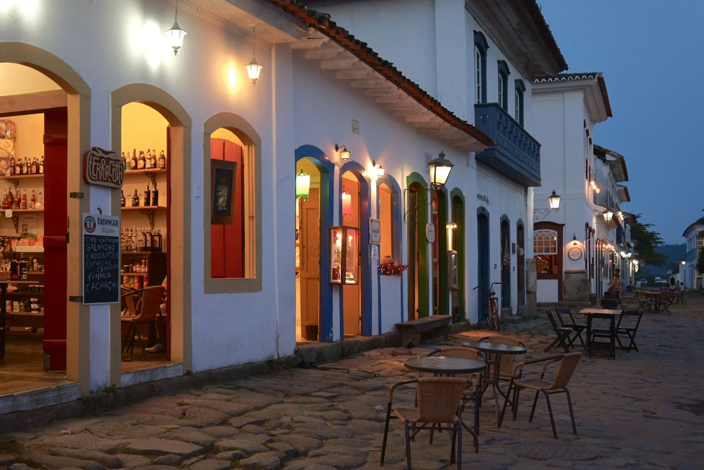
Paraty is the reason this coastline exists on the map: it was the port through which gold from Minas Gerais left for Portugal, and the historic center stopped in the 18th century in a way no other Brazilian coastal town managed. Stone streets designed for the tide to come in, churches once divided by social class, studios and cachaça houses in the old townhouses. Half a day of walking covers the basics; a full day does it justice. And the sea is still the town’s front door: it is from Paraty that the Albatroz departs, our group’s 23 meter schooner, on routes of two to five nights through Ilha Grande and the Saco do Mamanguá, with a chef on board and the nights slept at anchor. You have dinner watching the old townhouses drift away and wake up at a beach that can only be reached by sea.
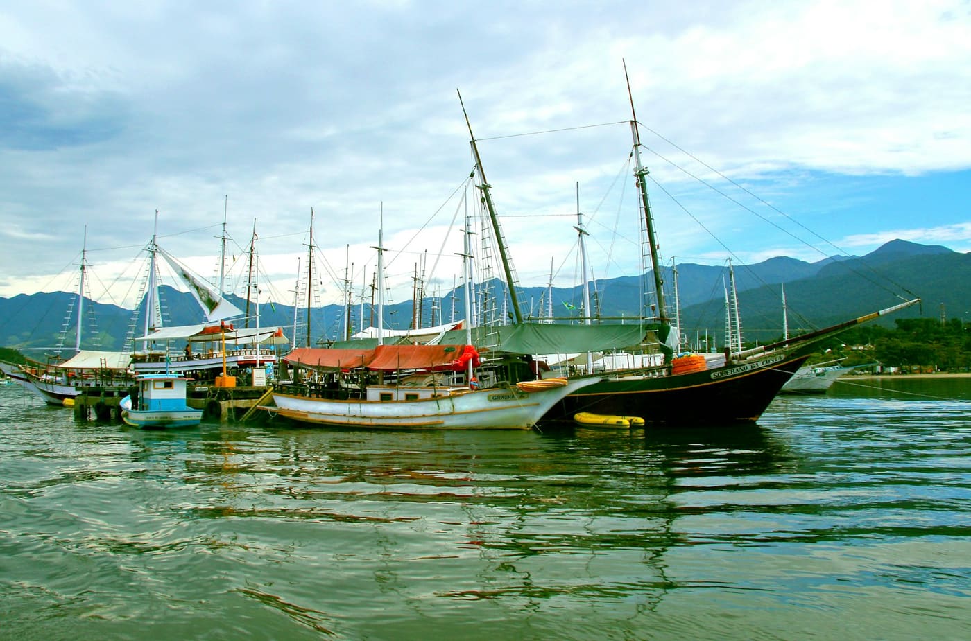 The Paraty pier, departure point for the schooners. Photo: Nareeta Martin, Unsplash
There is more history scattered around: the Caminho do Ouro, a paved section of the colonial gold trail in the mountains above Paraty; the Museu do Cárcere in the ruins of the Dois Rios prison, on Ilha Grande, which operated until 1993; and the ruins of the Ilha Anchieta prison, in Ubatuba, today a state park visited by schooners out of Saco da Ribeira.
If what moves you is hiking
The Costa Verde is essentially preserved Atlantic Forest with the sea at the end of every walk. The classics: Pico do Papagaio, on Ilha Grande, a hard 982 meter climb most people do in the small hours to reach the top at sunrise; the 16 km traverse to Bonete, in Ilhabela, crossing waterfalls; and the Pão de Açúcar do Mamanguá, in Paraty, overlooking the country’s only tropical fjord. For anyone who just wants to dip a toe in the idea, the Lopes Mendes trail takes 20 minutes.
We gathered the difficulty, time and logistics of each in the best hikes on the Costa Verde, and the waterfalls that appear along the way are in the best waterfalls on the Costa Verde.
If what moves you is nightlife
Let us be honest: the Costa Verde is not a party destination, and that is part of the charm. But it has its hubs. Maresias concentrates the nightlife of the São Paulo north shore, with bars and venues that fill up in summer a few meters from the 5 km of beach that shaped Gabriel Medina. Vila do Abraão, on Ilha Grande, has a circuit of street bars that works precisely because nobody has to drive home. And Paraty turns into a party on specific dates: FLIP in July, the cachaça festival in August, the Bloco da Lama carnival parade at Jabaquara. Outside those windows, the evening program is a good dinner and an early night for the next day’s trail.
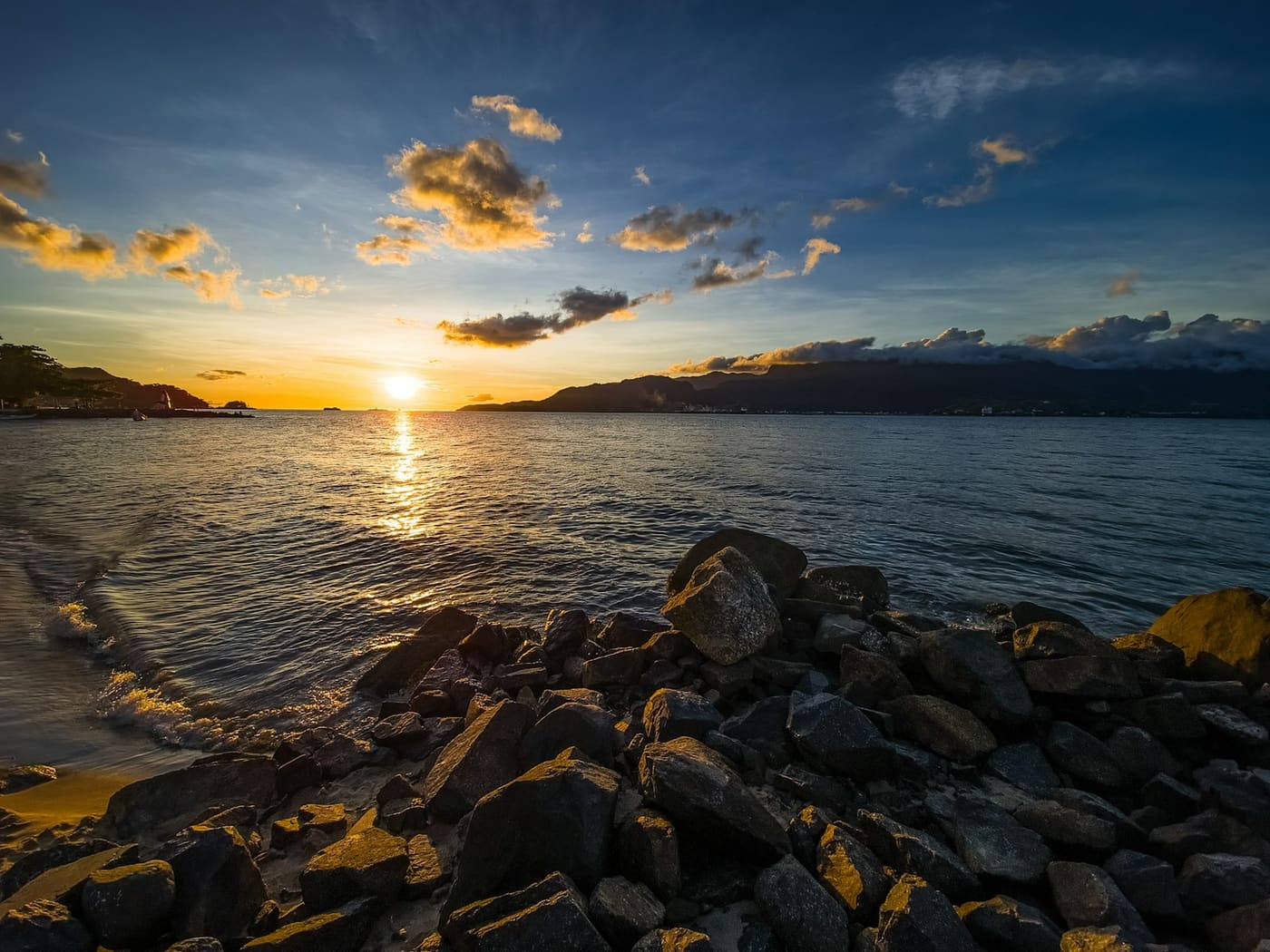 End of day on the São Sebastião channel, in Ilhabela. Photo: Vitor Camilo, Unsplash
How many days to detour
With 2 days, choose a single destination along the way: Paraty works with the historic center plus a schooner, Ilhabela works with a beach plus a waterfall. With 4, you can sleep in two places and cross the state line without hurry. With 7, the whole corridor fits: Ilha Grande, Paraty, Ubatuba and Ilhabela, in the order our 7 day itinerary lays out day by day.
Two calendar tips from people who live here. April, May, September and October are the months with less rain, fewer people and lower prices; on long holiday weekends, road times on the Rio-Santos double without ceremony, so avoid arriving or leaving at peak hours. And winter hides a bonus: between May and August, humpback whales pass along the São Paulo north shore, with sightings peaking in June and July. The month by month detail is in the guide to the best time to visit the Costa Verde.
Next time someone tells you that between São Paulo and Rio there is only the Dutra and the air shuttle, you will know better: there is an entire coastline. And it is not a layover. It is a destination. When you want to turn the idea into a plan, the 7 day Costa Verde itinerary is the shortest path.