
Things to do in Paraty beyond the historic center
Paraty’s colonial houses are so photogenic they hijack the trip: plenty of people spend three full days inside a ten block radius and go home believing they have seen the town. They have seen its capital. The municipality is one of the largest preserved territories on the Brazilian coast, with the Serra da Bocaina on one side, about 60 beaches and 65 islands on the other, and caiçara, quilombola and indigenous communities scattered in between. We write this with the familiarity of people who move through this map every week: the Albatroz, our group’s schooner, sails out of Marina Píer 46 and lives precisely in the part of Paraty that never makes the postcards.
This guide maps what exists past the cobblestones, region by region and with real logistics. The historic center has a guide of its own; here begins the rest.
Caminho do Ouro: the mountains that explain the old town
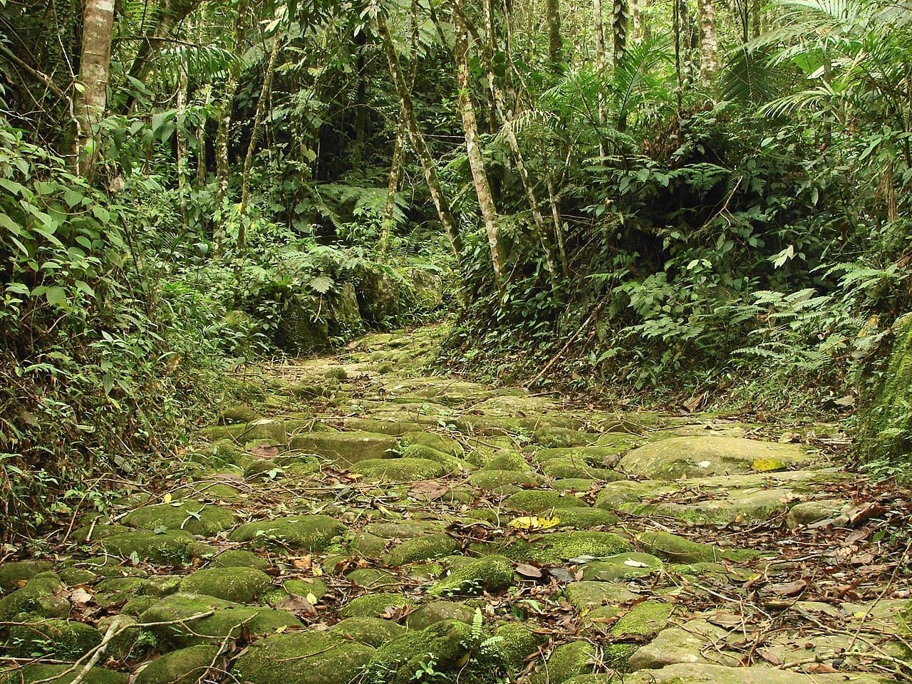
Before there was a pretty town, there was a road. The Caminho do Ouro, the Gold Trail, is the stretch paved in the 18th century to carry gold from Minas Gerais down to the port of Paraty, and a restored section of it can be visited inside Serra da Bocaina National Park, up the Paraty-Cunha road. The starting point is in the Penha neighborhood, and visits are only allowed with an authorized guide, because the route crosses private land. Book a day ahead through the agencies in the center; prices vary by operator and time of year, so confirm when you close the deal.
Is it worth the effort? It is, and for a reason that is not obvious: walking on stones laid three centuries ago, with the forest closing over your head, turns the historic center from scenery into consequence. All those colonial houses exist because these stones existed first. The same Penha neighborhood holds well known waterfalls, like the Escorrega, which makes the climb a full day out.
The Paraty-Cunha distilleries: cachaça at the source
The same mountain road concentrates the town’s other tradition: cachaça. Paraty was one of colonial Brazil’s great producing hubs, and the region’s distilleries still make it and welcome visitors for tastings. Watching the copper stills work, smelling the mash and tasting the white spirit a few meters from where it was born is half a day well spent, ideally stitched onto the Caminho do Ouro. The usual warning: whoever drives does not taste, so sort out transport before you leave.
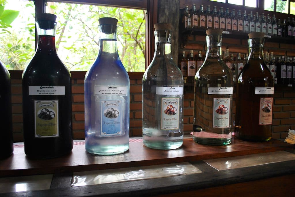 Copper still in the Paraty region. Photo: Luiz Pantoja, CC BY 2.0, Flickr
Trindade: the open sea village
South of the center, 27 km away, Trindade is Paraty’s rough side: open sea beaches, pale sand and the Bocaina range dropping straight into the water. The Cachadaço natural pool, at the end of the string of beaches, is the reason the village appears on every list about the town, and fairly so: water at your waist, boulders all around, fish at your shins. The municipal Colitur bus takes you there for about R$ 5 from the bus station. The other side of the fame: on holidays and in summer, the access road jams early and the village fills up. A weekday outside high season is a different Trindade.
Praia do Sono and Antigos: where the road gives up
After Trindade, the southern coastline continues, but the asphalt does not. Praia do Sono is reached by a trail of about 3 km from the Laranjeiras condominium, or by boat from the same area. It is a caiçara village with campsites and simple restaurants, facing a sea with no construction on the horizon. Whoever sleeps there (instead of day tripping) understands the name, which means “sleep”. Walking on past Sono, the trail continues to Antigos beach, emptier still, for anyone who wants to stretch the hike.
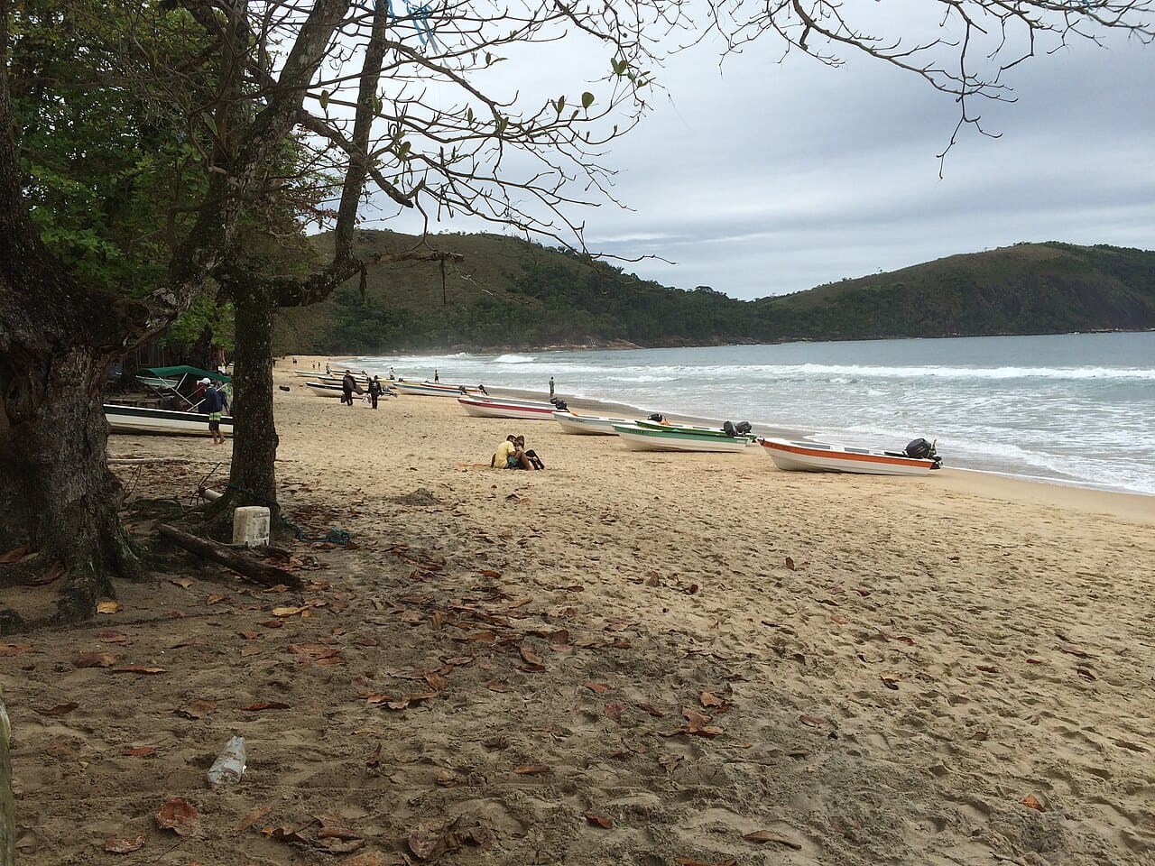 Praia do Sono: no road, by choice and by luck. Photo: TMbux, CC BY-SA 3.0, Wikimedia Commons
The Sono and Antigos pair is the most backpacker friendly plan in this guide, and features prominently on our map of the most authentic places on the Costa Verde. Bring cash and do not count on phone signal.
Paraty-Mirim: the beach with a church from 1720
Some 17 km south of the center (8 km on the Rio-Santos highway plus 8 km of secondary road, part of it dirt), Paraty-Mirim is a calm water cove with one detail that sets it apart from every other beach on this list: a colonial church on the sand. The chapel of Nossa Senhora da Conceição, raised in 1720, still stands simple and whitewashed at the edge of the sea, with the ruins of the old settlement being swallowed by the vegetation around it. The Colitur bus gets there for about R$ 5 and stops a few steps from the church, and the access road passes a Guarani village where you can buy handicrafts.
It is a half day outing, with no physical effort, and one of the best places in the municipality to understand that Paraty was a network of ports and villages, not a single town. The cove’s calm water suits anyone traveling with small children, and the contrast of resting your eyes on a three hundred year old church with your feet in the sand exists nowhere else in this guide.
Saco do Mamanguá: the fjord
The high point of this guide, and we own the preference. Saco do Mamanguá is a long, narrow arm of sea squeezed between Atlantic Forest hills, with mirror flat water, caiçara communities on the beaches and the Pão de Açúcar do Mamanguá trail ending at the most beautiful lookout in the region. There is no access road: it is boat or nothing, and that is what preserved it.
You can visit on a speedboat day trip, but Mamanguá has two hours the day trip never sees: late afternoon, when the wind dies and the fjord becomes a dark mirror, and dawn, when the mist lifts off the water. We know those two hours because we sleep there: the 2 night Albatroz expedition anchors inside the fjord and ends the day with a bonfire gathering on the beach, at the foot of the Sugarloaf peak, before returning to Paraty the next day. Of the experiences this blog covers, it is the one we would most recommend to a friend with two days to spare.
The caiçara communities of the sea: Cajaíba and its neighbors
Between the center and Mamanguá, the coastline hides coves that can only be reached by water, where caiçara communities live from fishing and, increasingly, from hosting travelers at their own pace. Praia Grande da Cajaíba is the example we know up close: a village with no road, a waterfall minutes from the sand and Dona Dica’s stingray pastel as a local institution. The Cajaíba cove has its own article for anyone who wants to go deeper.
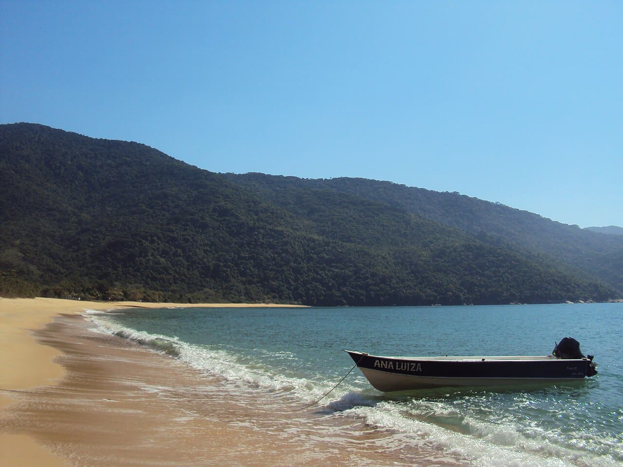 Praia Grande da Cajaíba, reachable only by boat. Photo: Mariana Pacheco, CC BY-SA 3.0, Wikimedia Commons
A note on manners, because it matters: these villages are not staged attractions. They are people’s homes. Buy the pastel, pay a fair price, take your trash back with you and treat the silence as part of the landscape.
When to visit each corner
The territory beyond the old town runs on its own calendar. The mountains (Caminho do Ouro, distilleries, waterfalls) prefer the dry season from May to September: wet paving stones turn to soap and guided visits are sometimes suspended in heavy rain. The sea (Mamanguá, Cajaíba, Paraty-Mirim) works year round, with winter keeping the clearest days and the clearest water. Trindade, Sono and Antigos ask for a double check: the swell forecast if you want to swim, and the holiday calendar if you want peace, because they are the first places to fill up. The full month by month picture of weather and crowds is in best time to visit Paraty.
How to fit all this into your trip
The honest math: the historic center asks for one day; each block of this guide asks for anything from half a day (Paraty-Mirim, distilleries) to two days (Mamanguá with an overnight, Sono with a night there). In other words, all of Paraty does not fit into three days, and that is fine. Our 3 day and 5 day itineraries show two possible builds, the tour ranking orders the options by traveler profile and the article on how many days to stay in Paraty closes the scheduling math. Rain along the way has its own plan in things to do in Paraty when it rains, and arrival logistics live in how to get to Paraty.
To close
The historic center is Paraty’s front door, and doors exist to be walked through. On the other side there are mountains with three century old stones, cachaça coming off the copper, villages without roads and a fjord that turns to glass when the wind sleeps. It is another trip, bigger and quieter than the one through the old town.
Pick a single place from this guide for your next visit and start there. If it is Mamanguá, we will cross paths.